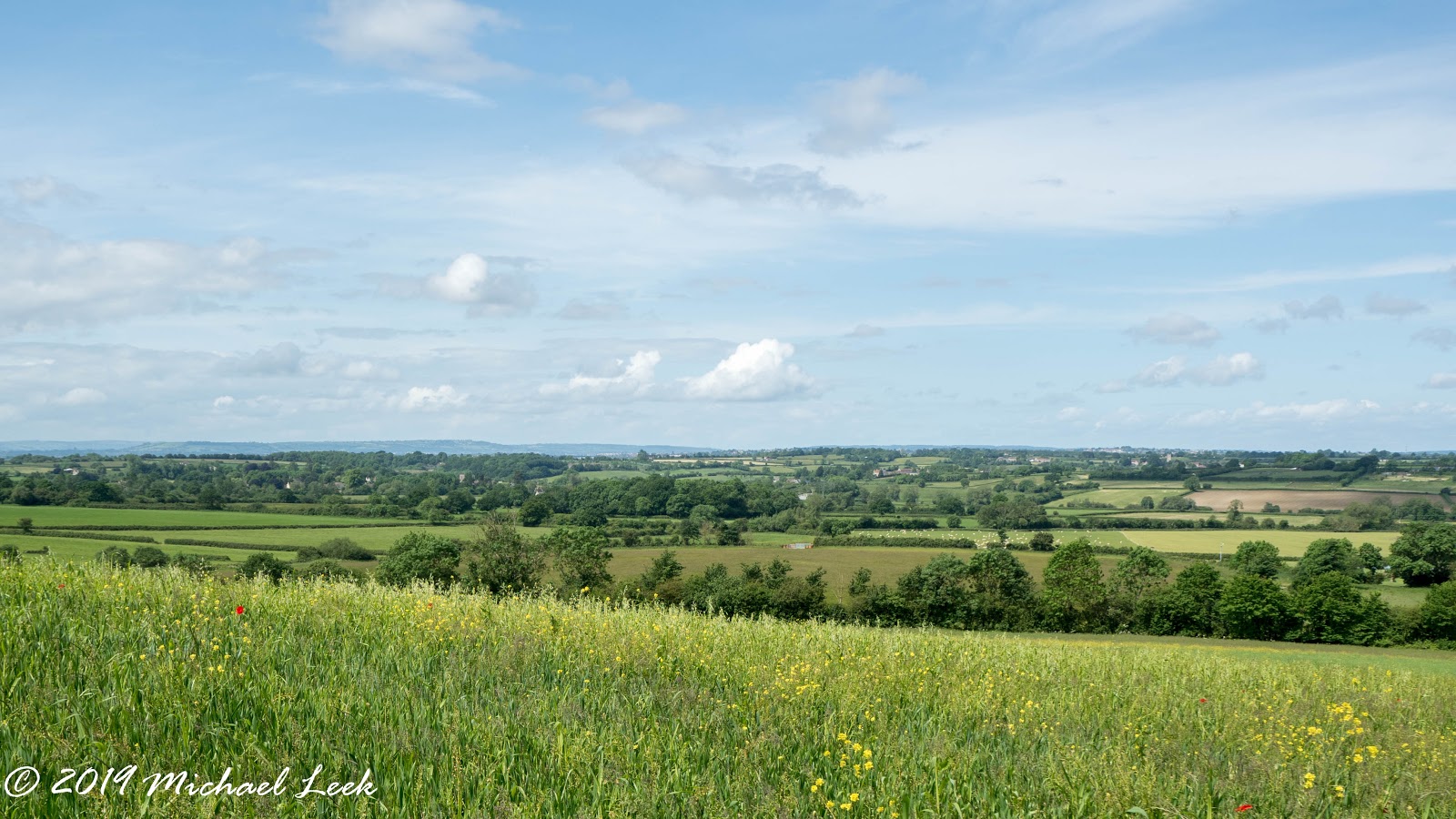
The second leg of the Cotswold Way starting at Cold Ashton. The route goes through Dryham Wood, past Dryham Park, around the edge of Hinton Hill, across the M4 to Tomarton. On through Dodington Park, Old Sodbury and over the hill fort at Little Sodbury.
Perfect walking weather with clear long distance views, not too hot and gentle breeze.
10.5 Miles and 1000 feet ascent.
Click here for the first leg
Click her for the third leg
The Manor House at Cold Ashton
Cold Ashton church.
Of course, the cows just wanted to be friendly and came up close.
Views across to the Forest of Dean
The west view of Dryham House and church
Hinton Hill Fort with the Strip Lynchets clearly visible just below.
Power lines
Beacon Lane Plantation
Across the M4 and a stop for lunch.
Dodington Park
The east entrance to Dodington House - home of Sir James Dyson
A steeper bit up to....
...the church at Old Sodbury - May Hill and the Tyndale Monument are just visible in the far distance
The Iorn Age hill fort at Little Sodbury
Part of the double ramparts on the north side.
Finally down the track through the woods to Little Sodbury.
My Country Walks
Previously living on the edge of Dartmoor I shared details of my walks on Dartmoor on my previous blog My Dartmoor Walks. As I explore this new area I will share details of the routes here.
Click on any photo to enlarge it.
Showing posts with label Cold Ashton. Show all posts
Wednesday 1st May 2019 Cotswold Way - Bath to Cold Ashton
The first leg of the Cotswold Way. A series of walks organised by the Cotswold Wardens. There is one walk each month and this group will complete the 104 mile walk to Chipping Campden in March next year.
Everyone gets on the coach at Winchcombe (very concvenient for me) and we are taken to the start - the coach is waiting at the end of the walk. The coach driver didn't seem to know the way to the M5 and for reasons only known to him he took us all the way into Cheltenham and then back out again! Eventually we arrived in Bath.
The Cotswold Way goes out through Bath, past The Circus, the Royal Crescent and Victoria Park. On to Primrose Hill, through the suberb of Weston and then out into the countryside going steeply up Penn Hill. Continuing more gently upwards and around the edge of Kelston Round Hill. Up again to the topograph by Prospect Stile on the edge of Bath Racecourse. Then flat for a while through Lansdown Golf Course and on to Hanging Hill. Shortly after the monument to Sir Basil Grenville the path goes down to the Ford on Hall Lane. The final stretch was a steep uphill section past Hall Farm. The coach was waiting for us at the top by junction with the A46.
9.8 miles and 1660 feet of ascent.
Click here for the second leg
The start and end of the walk is outside the Abbey and is marked by this sculpture embedded into the ground.
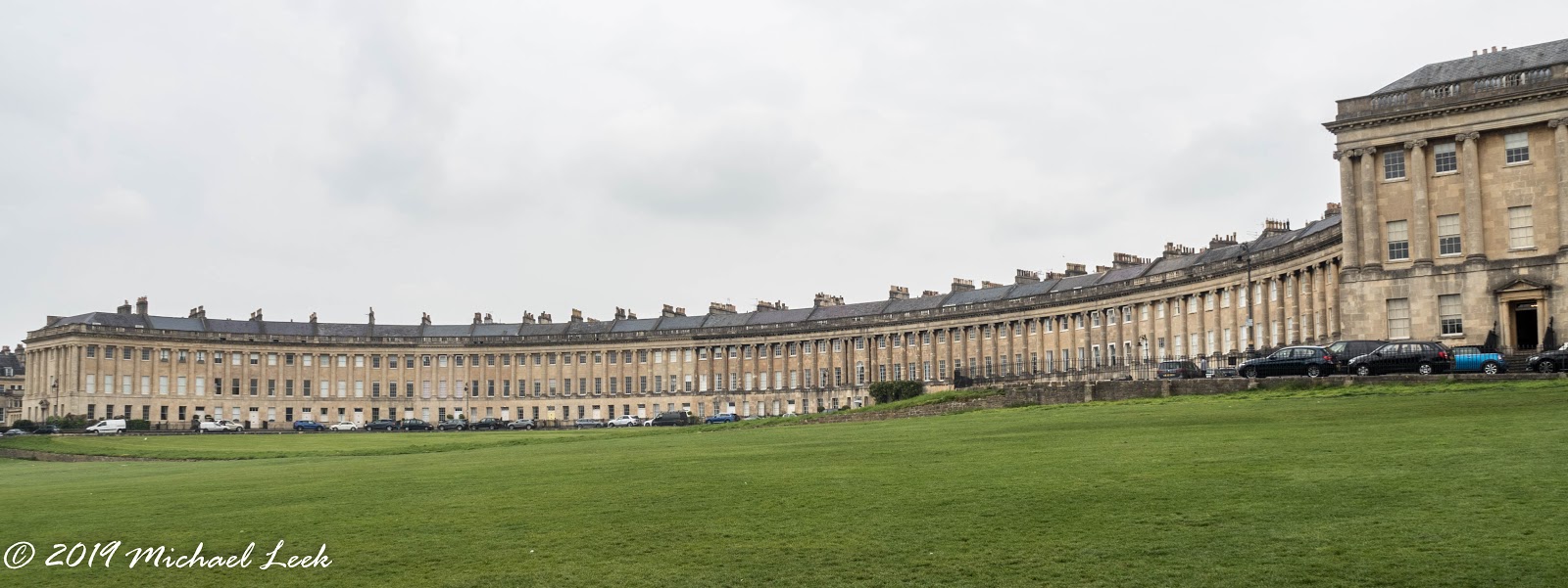
Royal Crescent
Victoria Park
Steeply up Penn Hill...
...to the trig point from where you would get fine views over Bath on a clear day.
The route past Pendean Farm
The topograph at Prospect Stile - looking back to Kelston Round Hill...
...right next to the edge of Bath Racecourse.
Looking over Little Down
Sculptures by Michael David Morse on the edge of Lansdown Golf Course
Looking over Hanging Hill.
Lansdown Hill was the site of a battle in the Civil War in 1643. The Royalist army was marching to Bath.
These marker posts on the Cotswold Way show the area of the battle.
The monument to Sir Basil Grenville, erected by his son, marks the place where he fell. He died the following day.
Masses of wild garlic
The path ahead from the edge of the battleground
These cows followed us down the hill and charged twice - not pleasant for those of us at the back!
Everyone gets on the coach at Winchcombe (very concvenient for me) and we are taken to the start - the coach is waiting at the end of the walk. The coach driver didn't seem to know the way to the M5 and for reasons only known to him he took us all the way into Cheltenham and then back out again! Eventually we arrived in Bath.
The Cotswold Way goes out through Bath, past The Circus, the Royal Crescent and Victoria Park. On to Primrose Hill, through the suberb of Weston and then out into the countryside going steeply up Penn Hill. Continuing more gently upwards and around the edge of Kelston Round Hill. Up again to the topograph by Prospect Stile on the edge of Bath Racecourse. Then flat for a while through Lansdown Golf Course and on to Hanging Hill. Shortly after the monument to Sir Basil Grenville the path goes down to the Ford on Hall Lane. The final stretch was a steep uphill section past Hall Farm. The coach was waiting for us at the top by junction with the A46.
9.8 miles and 1660 feet of ascent.
Click here for the second leg
The start and end of the walk is outside the Abbey and is marked by this sculpture embedded into the ground.
Royal Crescent
Victoria Park
Steeply up Penn Hill...
...to the trig point from where you would get fine views over Bath on a clear day.
The route past Pendean Farm
The topograph at Prospect Stile - looking back to Kelston Round Hill...
...right next to the edge of Bath Racecourse.
Looking over Little Down
Sculptures by Michael David Morse on the edge of Lansdown Golf Course
Looking over Hanging Hill.
Lansdown Hill was the site of a battle in the Civil War in 1643. The Royalist army was marching to Bath.
These marker posts on the Cotswold Way show the area of the battle.
The monument to Sir Basil Grenville, erected by his son, marks the place where he fell. He died the following day.
Masses of wild garlic
The path ahead from the edge of the battleground
These cows followed us down the hill and charged twice - not pleasant for those of us at the back!
Subscribe to:
Posts (Atom)